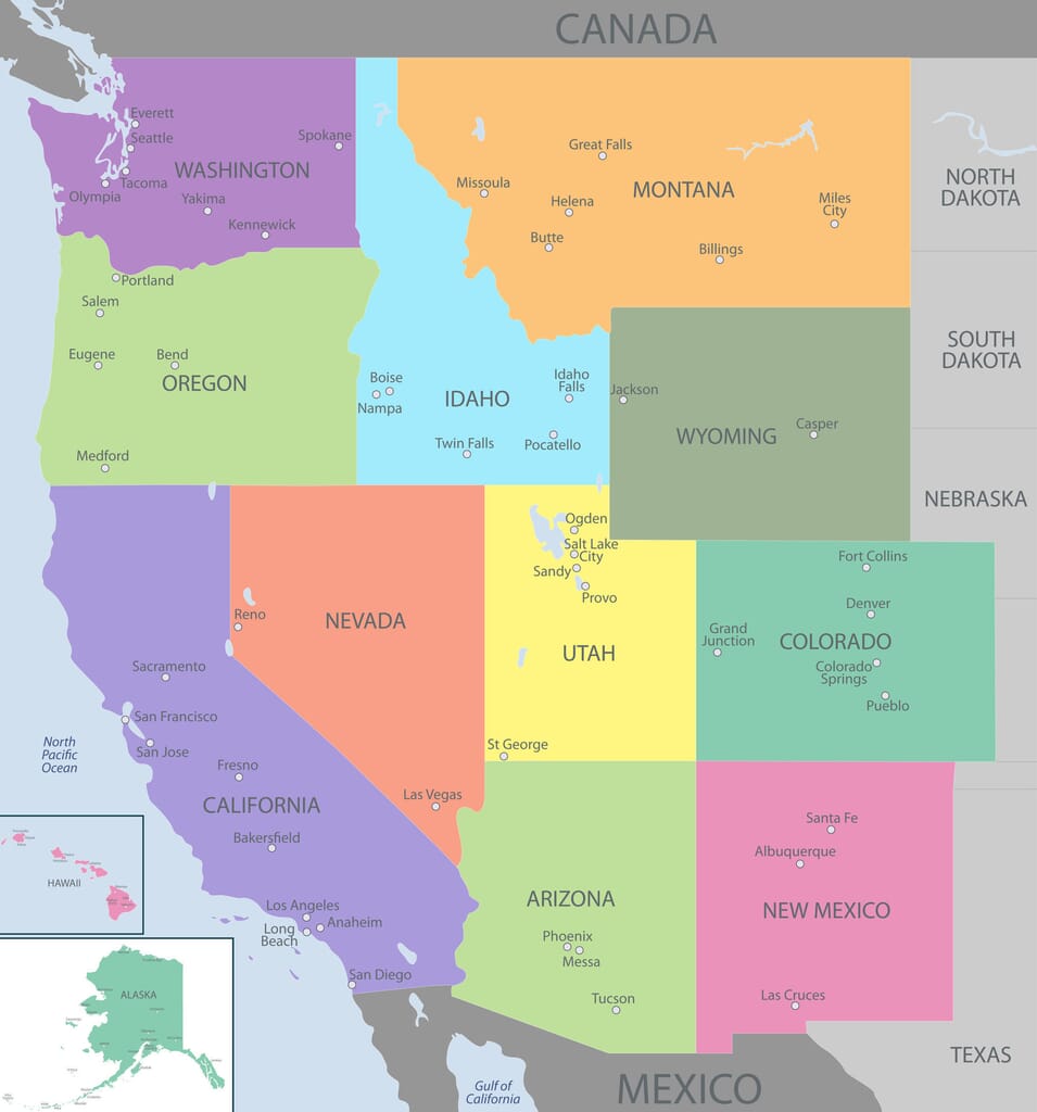
The Western United States makes up the largest of the five US regions, covering 4,851,699 square kilometers (1,873,252 square miles) and 13 states. The region makes up about half of the total area of the USA.
The size of the region also contributes to its high degree of geological diversity. The majority of the country’s deserts lie in this region, as do the country’s highest mountains, temperate rainforests, a section of the Great Plains, and several glaciers.
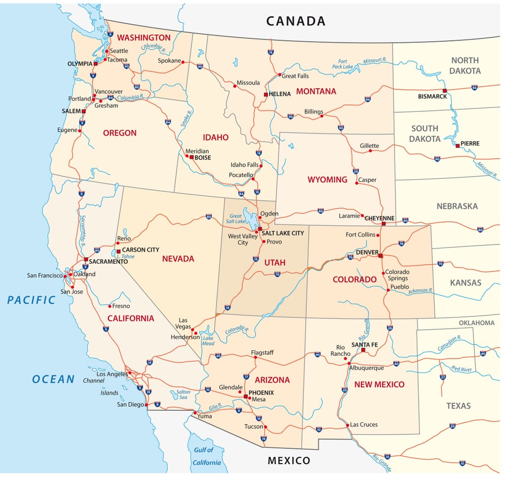
There are multiple definitions used to describe the Western United States, also known as “The West” or “The American West.” The definition used by the Census Bureau is the one we’ll use in this post and what is described by the map below.

Total Area: 1,717,856 km 2 (663,268 mi 2 )
2022 Population Estimate: 731,721
Alaska is the state in the Western United States with the greatest total area and the smallest total population. It was the 49th state to join the USA in 1959, and the area had previously been mostly controlled by Russia.
Prior to colonization, many indigenous peoples called the area that is now Alaska home. Some of these are the Tlingit, Aleuts, Haida, Yup’ik, Alutiiq, and Gwich’in. Many of these groups still live in the area.
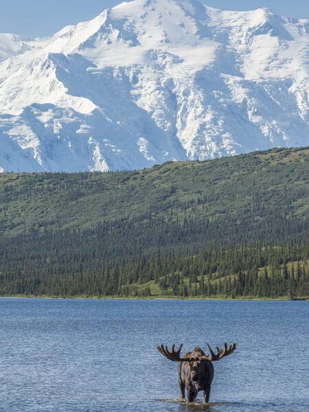
As the northernmost and westernmost state of the USA, Alaska is the only non-contiguous state in the country that is on the North American continent. It is characterized by large areas of uninhabited wilderness, mountains, millions of lakes, glaciers, and the Aleutian Islands.
Alaska is home to the Bering Glacier, the largest in North America.
Total Area: 295,234 km 2 (113,990 mi 2 )
2022 Population Estimate: 7,400,000
Arizona was the last contiguous state to be admitted to the USA, and the 48th state overall. It is located in the southwestern part of the country and shares a border with the Mexican states of Sonora and Baja California. There is a large population of indigenous peoples in Arizona, and about a quarter of the state is reservation land.
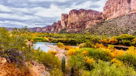
Geographically, Arizona has varied elevations that affect local climates. The state is home to deserts at its lower elevations in the south that see mild winters and very hot summers. The plateaus in the northern part of the state are at a higher elevation and are typically cooler though still arid.
Arizona is also home to one of the Seven Natural Wonders of the World, the Grand Canyon. The canyon is 446 km (277 mi) long, up to 29 km (18 mi) wide, and reaches a depth of 1.6 km (1 mi); it is mostly located in the country’s first national park.
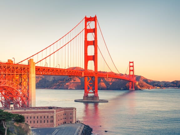
Total Area: 423,970 km 2 (163,696 mi 2 )
2022 Population: 39,185,605
California is the most populous state in the USA and the third largest. It borders the Pacific Ocean to the west, the Mexican state of Baja California to the south, and Oregon, Nevada, and Arizona to its north and east. The state of California also has the largest indigenous population of any state in the country.
Aside from its size and population, California is famous for its impact on global culture and technology. Hollywood, the world’s largest film industry, is located in this state and has an enormous impact on global entertainment. California is also considered the birthplace of personal computers and where many tech companies have their headquarters.
The large size of California gives it a range of climates and geographic features. There are temperate rainforests in the north, snowy alpine regions, an arid desert in the interior, and a Mediterranean climate along the coast. Droughts are frequent in California, and water security is a frequent source of concern.
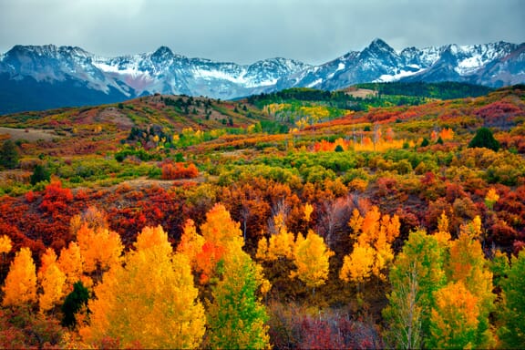
Total Area: 269,837 km 2 (104,094 mi 2 )
Estimated 2022 Population: 5,850,000
Colorado has the nickname of the “Centennial State” because it acquired statehood one hundred years after the declaration of independence of the United States. However, the region is thought to have been inhabited by indigenous peoples for more than 13,000 years.
One of Colorado’s most famous features is its landscape. There are picturesque mountains, plains, forests, canyons, mesas, rivers, deserts, and plateaus that cross the state and attract people from all over the country. There are 53 Rocky Mountain peaks within the state of Colorado, and the many ski resorts in the Western Slope region attract enthusiasts of snow sports.
About 22% of Colorado’s population is of Hispanic or Latin American heritage, and the largest ancestry group in the state is German at 22% of the population. There are many Spanish idioms in the spoken English used in Colorado due to its relatively large Hispanic population.
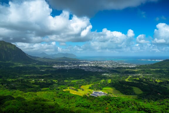
Total Area: 28,311 km 2 (10,931 mi 2 )
2022 Population Estimate: 1,430,000
Hawaii was the 50th and last state to join the USA in 1959, after Alaska. It had been a territory of the United States since 1898, after the overthrow of the Hawaiian Kingdom by Western businessmen in 1893.
The state of Hawaii is unique as the only state not in North America, the only state in the tropics, and the only archipelago state. It’s located in the Pacific Ocean about 2,000 miles from the mainland, and it is the eighth-smallest state in the union.
Due to the beautiful beaches and pleasant climate that lasts all year, Hawaii is a popular tourist destination, which is an important part of its economy. In addition to tourists from other US states, there is a high number of Japanese, Chinese, and Korean tourists that visit the islands each year. Holidays tend to be the busiest dates for tourism.
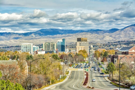
Total Area: 216,443 km 2 (83,569 mi 2 )
2022 Population Estimate: 1,980,000
The state of Idaho lies in the Pacific Northwest region of the United States, although it is the only state in this region without any coastline. It shares a small border with Canada to the north and with six other states to the east, south, and west.
Idaho has a fairly dynamic landscape, with large areas of unspoiled wilderness. The Frank Church-River of No Return Wilderness Area is the largest contiguous wilderness area in the country outside of Alaska at a size of 2.3 million acres.
Some significant contributors to Idaho’s economy are the industries of food processing, timber production, and electronics manufacturing. The capital and most populous city of Idaho is Boise, which is located in the southwestern corner of the state.
Total Area: 380,800 km 2 (147,040 mi 2 )
Estimated 2022 Population: 1,140,000
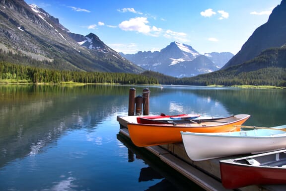
Montana is located in the northwestern United States, bordering Canada to the north as well as four other states. It is the fourth-largest state in the country and is often referred to by its unofficial nickname, “Big Sky Country.”
The name of this state comes from the Spanish word montaña which means “mountain.” There are multiple mountain ranges in the western part of the state, but about 60% of Montana’s topography is prairie. Rivers and valleys also populate the state, as does a diverse group of fauna, including the largest grizzly bear population in the lower 48 states.
Montana is known for its abundance of natural and mineral resources. Gold, silver, copper, coal, sapphire, and other resources are mined in the state, making significant contributions to the economy along with the timber industry.
Total Area: 286,382 km 2 (110,577 mi 2 )
2022 Population Estimate: 3,200,000
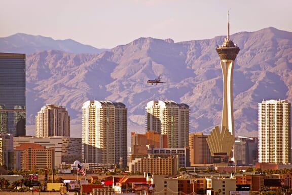
Nevada is a landlocked state that is surrounded by California, Oregon, Idaho, Utah, and Arizona. It is home to the world-famous resort city of Las Vegas and is known as the “Silver State.”
The name of this state comes from the Spanish word for “snowy,” but the state is mostly covered in deserts with a semi-arid climate. The name refers to the overlap of the Sierra Nevada mountain range, though this only makes up a small section of the state.
The first Europeans to explore the area that is now Nevada were Spanish, and the Native American, Paiute, Shoshone, and Washoe tribes inhabited the land prior to their arrival. The area was then controlled by Mexico, annexed by the USA, and became the 39th state in 1864.
Total Area: 314,918 km 2 (121,591 mi 2 )
2022 Population Estimate: 2,100,000
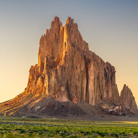
New Mexico is a state in the southwestern United States that shares a small border with the Mexican states of Sonora and Chihuahua to the south as well as six other US states. It is the fifth-largest state of the union and its capital city, Santa Fe, is the oldest in the country.
With forests, mountains, and sparse deserts, the climate in New Mexico varies greatly from region to region. The northeastern parts of the state are generally cooler, and the southwestern areas are warmer and dryer. The Rio Grande river runs through the center of the state from North to South and provides a green valley with a riparian climate.
There are three UNESCO World Heritage Sites in Nevada, which is the most of any state. These are Taos Pueblo, Chaco Canyon, and Carlsbad Caverns.
Total Area: 254,806 km 2 (98,381 mi 2 )
2022 Population Estimate: 4,250,000
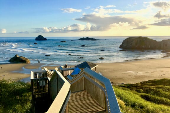
Oregon is located in the Pacific Northwest region of the United States, to the south of Washington and north of California and Nevada. It borders the Pacific Ocean to the west and Idaho to the east.
Geographical diversity is very high in Oregon; there are volcanoes, several types of forests, extensive shrublands, high deserts, and many bodies of water. Crater Lake, the deepest lake in the USA is also a part of this landscape.
Agriculture, fishing, and hydroelectric power are the main contributors to the state’s economy, and the state is one of the nation’s top lumber producers. There are also a growing number of technology-related businesses in the state, and its largest public corporation is sportswear company Nike, headquartered in the city of Beaverton.
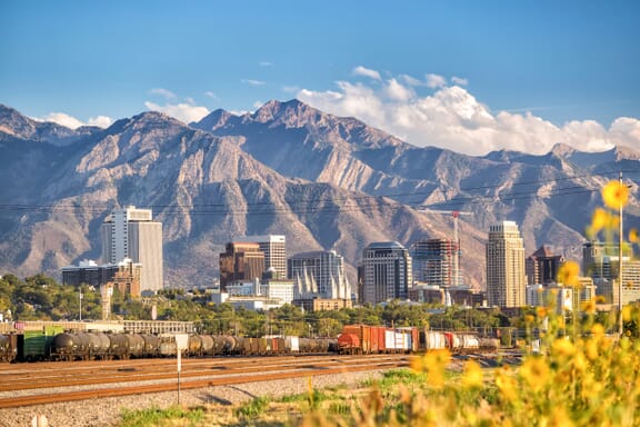
Total Area: 219,887 km 2 (84,899 mi 2 )
2022 Population Estimate: 3,420,000
Utah is a landlocked state bordered by six others in the Western United States. Inhabited for thousands of years by the Ancient Puebloans, Navajo, and Ute peoples, Utah became the 45th state of the USA in 1896.
This state is known for its high Mormon population, the majority of whom belong to the Church of Latter-Day Saints (LDS), which is headquartered in the state’s capital, Salt Lake City. Utah is also known for beautiful national parks such as Zion, Arches, Bryce Canyon, and several others. It’s also home to some world-famous ski resorts.
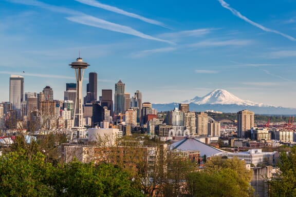
Total Area: 184,827 km 2 (71,362 mi 2 )
2022 Population Estimate: 7,760,000
Washington is the northwesternmost state in the USA, bordering the Canadian province of British Columbia to the north, the Pacific Ocean to the west, Idaho to the east, and Oregon to the south. The area was inhabited by large indigenous populations prior to European arrival, and people of many tribes still live in the state.
The state of Washington is known for being socially liberal, its beautiful landscape, and for being the home of giant corporations like Amazon, Starbucks, and Boeing. The state’s tallest mountain, Mount Rainier, has the highest topographic prominence of any in the country. The state is also the Hoh Rainforest, a large temperate rainforest that has been designated a UNESCO World Heritage Site.
The capital city of Washington is Olympia, and the largest city is Seattle. Seattle was home to the grunge music scene in the mid-1980s and continues to host a vibrant music culture.
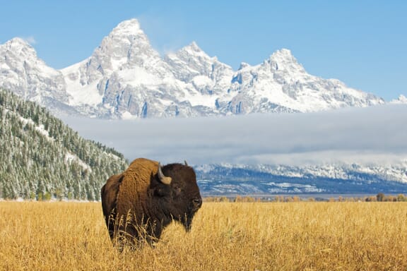
Total Area: 253,600 km 2 (97,914 mi 2 )
2022 Population Estimate: 581,813
Wyoming is the least populous state in the USA and is located in the country’s Mountain West subregion. The Arapaho, Crow, Lakota, and Shoshone are some of the tribes that inhabit the state currently and for thousands of years prior. Wyoming became the 44th US state in 1890.
The eastern half of Wyoming is mostly covered in prairie land called the High Plains, and the western portion of the state is home to ranges of the Rocky Mountains. There are temperature extremes throughout the year in Wyoming, and it’s drier and windier than most of the country.
Grand Teton and Yellowstone national parks are two major tourist attractions in Wyoming. Yellowstone was the first national park in the US, and many agree it was the first national park in the world.